
Scenic Route vs. Highway: Choosing the Right Drive for Your Trip
Highways are fast; scenic routes are memorable. Here's how to weigh the trade-offs and decide which approach fits your goals.
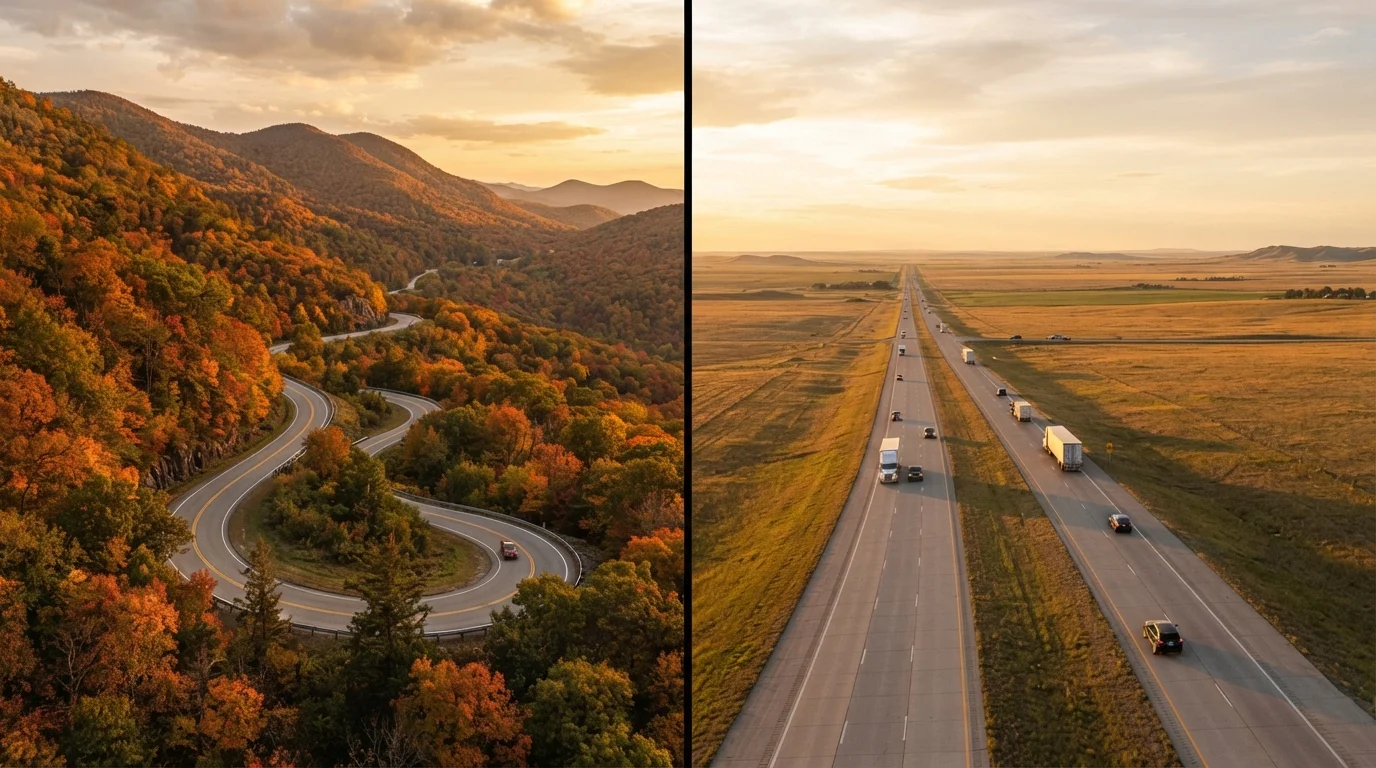
Photo: SaverSteals.com editorial
—— In This Article
Key Takeaways
- Highways minimize drive time; scenic routes maximize experience at the cost of hours and fuel.
- Your trip purpose — destination-focused vs. journey-focused — is the most important deciding factor.
- Scenic routes often have fewer services, so fuel and supply planning matters more.
- Mixing both route types within one trip is a practical strategy many experienced road-trippers use.
- Mapping tools can estimate scenic route times, but real-world stops routinely add extra hours.
- Weather, road conditions, and season significantly affect scenic route accessibility and safety.
What You're Actually Choosing Between
The scenic route vs. highway decision isn't just about roads — it reflects what you want from a trip. Highways (interstates and major US routes) are engineered for throughput: consistent speed limits, predictable rest areas, and minimal navigation complexity. Scenic routes — which include state-designated byways, National Scenic Byways, and two-lane back roads — are designed to move you through landscape, history, and community rather than past them.
Before picking a route, clarify your trip's purpose. Are you trying to get somewhere, or is getting there the goal? If your destination is a wedding, a work event, or a national park that closes at dusk, the highway keeps the plan intact. If the road trip is the vacation itself, scenic routes deliver an experience no interstate can replicate.
For a broader framework on how these decisions fit into trip planning, see our road trip planning starting point.
Side-by-Side: How They Stack Up
The table below compares the two approaches across criteria that matter most to everyday drivers. No single factor decides the call — but seeing them together helps clarify trade-offs.
| Criterion | Scenic Route | Highway |
|---|---|---|
| Travel speed | Slower (35–55 mph typical) | Faster (65–80 mph typical) |
| Navigation complexity | Higher — more turns, signage gaps | Low — straightforward exits |
| Services (gas, food, lodging) | Sparse, sometimes 50+ miles apart | Frequent, predictable intervals |
| Scenery and experience | Rich — landscape, towns, history | Minimal — functional corridor |
| Fuel efficiency | Moderate speed, more miles driven | Higher speed, fewer miles driven |
| Weather/seasonal risk | Higher — road closures common | Lower — better maintained year-round |
| Flexibility for stops | High — organic and spontaneous | Low — limited exit options |
| Predictable arrival time | Difficult to guarantee | Reliable under normal conditions |
One factor the table can't fully capture: predictability. Highways are highly consistent across the country. Scenic routes vary enormously — a well-maintained byway in the Southwest is a very different proposition from an unmaintained forest road after spring snowmelt. Always verify current road conditions through your state's DOT website or a reliable mapping app before committing to a back-road route. Our guide on how mapping tools work for road trips explains how to read route estimates more accurately.
The Hidden Costs of Each Option
Highway driving looks cheaper on paper — straighter roads, fewer stops, less time on the clock. But sustained high-speed driving increases fuel consumption noticeably compared to moderate-speed scenic driving. A 70-mph interstate pace burns meaningfully more fuel per mile than a 45-mph state route for most vehicles, though the faster trip means you reach the pump sooner.
150+
US National Scenic Byways designated
The Federal Highway Administration's National Scenic Byways Program has recognized routes across 48 states, offering curated alternatives to interstate travel.
~14%
Fuel economy drop at 70 vs. 55 mph
The US Department of Energy estimates that fuel economy decreases roughly 14% when driving at 70 mph compared to 55 mph for many passenger vehicles.
3 in 4
US adults who have taken a road trip
Survey data from the American Automobile Association consistently shows road trips are among the most common vacation formats for American households.
Scenic routes carry a different set of hidden costs. Gas stations may be 50–80 miles apart on rural byways; cell service can drop entirely in mountainous corridors. Running low on fuel or getting a flat tire in a remote area can turn a beautiful afternoon into a stressful multi-hour delay. Build a supply buffer — fuel up before the tank hits a quarter, carry water and a basic emergency kit, and download offline maps before you leave coverage. For a full pre-departure checklist, see our road trip safety habits guide.
Making the Two Work Together
Experienced road-trippers often don't choose one or the other — they sequence both. A practical approach: use the highway to bridge long, unremarkable stretches (think agricultural flatlands or industrial corridors), then exit onto a designated scenic byway when the landscape becomes worth slowing down for.
The US National Scenic Byways Program has designated more than 150 routes across 48 states, many of which run parallel to nearby interstates for portions of their length. This makes hybrid routing genuinely easy — you can often add 30–90 minutes to a highway journey and gain several hours of scenic experience in return.
Spontaneous stops are one of the most rewarding parts of scenic driving. Our piece on unexpected stops that make a road trip memorable offers practical advice on finding and fitting detours into your day without blowing your schedule entirely. For a comprehensive look at how route choice fits into the full planning process, the complete road trip planning guide covers everything from budgeting to overnight logistics.
Seasonal Access Can Change Everything
Many scenic byways in mountain and desert regions are closed or restricted seasonally — sometimes from late fall through early spring. Before finalizing a scenic route, check current access status with the managing agency (National Forest, state DOT, or National Park Service). Conditions can also change rapidly after storms, so verify close to your departure date, not just when you're planning weeks out.

Travel Editorial Team
Travel Editorial Team is the collective byline for our editorial team and contributor network. Articles published under this byline or an editorial pen name are researched, written, and reviewed according to our editorial standards for clarity, consistency, and independence before publication.
View author profile